
Taylor Engineering is proud to announce that our work on the Florida Department of Environmental Protection (FDEP) Statewide Vulnerability Assessment has been recognized with an Engineering Excellence Award from the American Council of Engineering Companies of Florida.
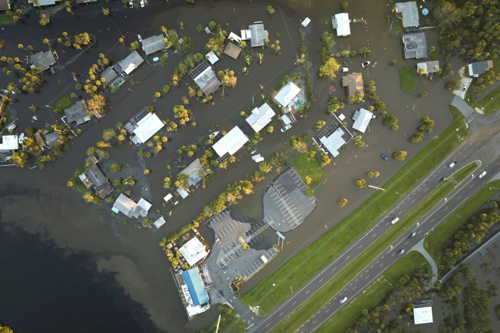
Across Florida, the FDEP has funded individual vulnerability assessments, which evaluate how flooding and other hazards could impact critical assets, infrastructure, and communities. However, there was no consistent, statewide view of the assets most at risk. A 2023 legislative mandate required completion of a full statewide vulnerability assessment, creating an urgent need for a unified dataset and methodology to support statewide resilience planning.
Working alongside FDEP, the Taylor Engineering team developed a comprehensive statewide flood hazard dataset covering coastal, fluvial, and pluvial flooding. Using Florida-specific LiDAR, updated NOAA future rainfall factors, and the latest sea level rise projections, we applied advanced global flood modeling to accelerate delivery. Traditional 2D hydrologic and hydraulic modeling can take years per watershed; this approach allowed us to produce a consistent statewide dataset in months.
The assessment established a uniform baseline across all 67 Florida counties. In addition to mapping hazards, we evaluated more than 140,000 critical assets, including hospitals and cultural landmarks. Standardized risk criteria were developed for each asset type, and FDEP has adopted this framework as the statewide standard. For the first time, communities across Florida are evaluating flood risk using a consistent methodology to guide resilience planning and investment decisions.
The result is more than a dataset. It provides state and local leaders with a common foundation to support faster and more equitable decision-making. The project met the legislative mandate on schedule and required close coordination, innovation, and teamwork to deliver at the scale required.
The report data is publicly available on an interactive website with maps and dashboards. Anyone, from planners to school boards to residents, can explore potential vulnerabilities and see how flooding might affect schools, hospitals, utilities, and roads.
Link to the FDEP Statewide Vulnerability Assessment interactive map tool
Florida is our home, and the neighborhoods facing sea level rise and stronger storms are our communities and our neighbors. This work helps ensure resilience efforts across the state are consistent, informed, and truly serve Florida now and into the future. We’re proud to be a part of that effort.
Congratulations to FDEP and our project partners, Fathom and Jones Edmunds, on this important recognition.